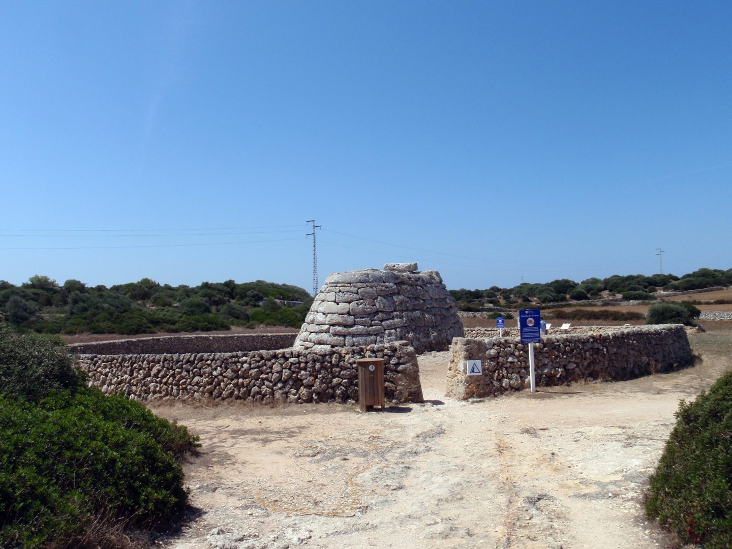
Talayotic Menorca: the island’s UNESCO World Heritage
Prehistoric monuments — talayots, taulas and navetas — make Menorca one of the richest archaeological islands in the Mediterranean.
Menorca has one of the densest concentrations of prehistoric monuments in the Mediterranean, scattered through fields, woods and coastal ravines rather than gathered in a single archaeological park. This guide explains what the monuments are, what UNESCO recognised and which sites are the easiest starting points. For seaside stops on the same trip, see the best beaches in Menorca, and for local flavours see what to eat in Menorca.
UNESCO listing
Talayotic Menorca was inscribed as a World Heritage Site in 2023, on 18 September according to the Spanish government. The property is made up of nine areas grouping around 280 sites.
Where to start
- Naveta des Tudons: collective tomb of around 1200–750 BC, 14.5 × 6.5 m, about 5 km from Ciutadella.
- Torre d’en Galmés (Alaior): inhabited since around 1400 BC, with three talayots, a taula and cisterns.
- Trepucó (about 2 km from Maó): a very well preserved taula.
What UNESCO recognised
According to UNESCO, the property is made up of archaeological sites in agro-pastoral landscapes, with settlements and burial places that span the Bronze Age, from around 1600 BCE, to the Late Iron Age, until 123 BCE, when Rome took the island. It was inscribed under criteria (iii) and (iv). UNESCO highlights a building tradition based on very large stones laid without mortar over some 1,500 years, and points to astronomical orientations and visual links between sites as signs of a hierarchical society. Camí de Cavalls 360º adds that the decision was taken on 18 September 2023 at the 45th session of the World Heritage Committee in Riyadh, after a candidacy lasting fourteen years.
The monuments in plain words
- Talayots: large, truncated cone-shaped towers of stone that give the culture its name. One regional tourism source describes them as dwellings, watchtowers or lookout points within settlements.
- Taulas: enclosures with a central T-shaped structure, presumed to have had a religious purpose.
- Navetas: burial buildings shaped like an upturned boat; the word means little boat in Catalan.
- Hypogea, circular houses and hypostyle halls: underground burial chambers, round dwellings and rooms whose roofs rest on pillars.
More than 1,500 Talayotic sites are known on an island of about 700 km², more than two per square kilometre according to Camí de Cavalls 360º. UNESCO protects 280 representative ones.
Naveta des Tudons in more detail
According to Descobreix Menorca, the naveta has two chambers linked by a small passage and is built from massive stones without mortar, with large slabs forming the intermediate floor and roof. Restoration work in the 1950s found at least 100 burials with grave goods such as bronze bracelets, bone buttons and pottery. It stands beside the Maó to Ciutadella road at around kilometre 40. You cannot go inside, and there is no public transport to the site, so most visitors arrive by car. Dates vary by source: Descobreix Menorca gives about 1200 to 750 BC, while Wikipedia gives 1050 to 850 BCE for the use of navetas.
Torre d’en Galmés in more detail
Torre d’en Galmés sits on a small hill between Alaior and Son Bou, with views over the south coast. According to Wikipedia it was occupied for roughly 2,400 years, until the end of Roman times. Besides the three talayots, walls and taula, look for the circular houses with a central patio, hearth and cistern, a hall with columns, and the system of cisterns and channels that collected rainwater running off the hill. It is one of the biggest settlements in the Balearic Islands.
Other sites worth knowing
An official tourism itinerary, the Route of the Talayots, also names Talatí de Dalt, whose central structure is intact; Torre Trencada, Ciutadella’s only standing taula; Torralba d’en Salort, which has the best-preserved taula on the island; and the Cala Morell necropolis. It describes Trepucó as the prehistoric capital of eastern Menorca. Many sites can be reached from the Camí de Cavalls 360º network, although they are not usually beside the main path.
Planning a visit
- Choose one or two sites a day, since they are spread across the island.
- There is little shade in summer, so go early or late and carry water.
- Stay on marked paths and respect fences.
- Opening hours and entry rules differ by site and season: check before you travel.
Son Bou beach, described in our beach guide, also has prehistoric burial openings in its eastern cliff.
Check opening hours and access before visiting.
Spanish detail: Menorca talayótica.
Frequently asked questions
When did Talayotic Menorca become a World Heritage Site?
In 2023, on 18 September.
How many sites does the listing include?
280 representative sites, grouped into nine areas.
What is a taula?
A monument with a central T-shaped structure, presumed to have been religious.
What is a naveta?
A prehistoric burial building shaped like an upturned boat.
Can I go inside the Naveta des Tudons?
No: according to Descobreix Menorca, visitors cannot enter for conservation and safety reasons.
Which period does the listing cover?
From the Bronze Age, around 1600 BCE, to the Late Iron Age, until 123 BCE.