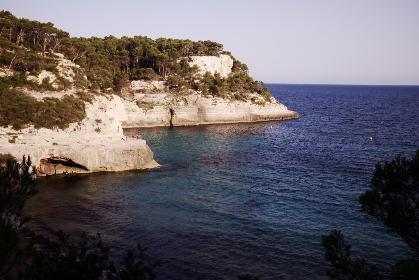
Best beaches in Menorca: what to know before you go
Menorca is known for its coves. Here is how the main ones work in practice, based on official and press sources.
Menorca is a small island, about 695.8 km² in area, yet its coastline changes character every few kilometres. In broad terms the south coast has pale sand and clear water in pine-backed coves, while the north is wilder and more exposed, with reddish-orange sand and fewer visitors. This guide gathers the beaches people ask about most and explains how to reach them. For flights and ferries, see getting to Menorca; for lunch after the beach, see what to eat in Menorca.
The southern coves
- Macarella and Macarelleta (Ciutadella): white, fine sand between limestone cliffs. The Camí de Cavalls stage 13 links Cala Turqueta and Cala Galdana.
- Cala Turqueta: a popular cove with pine trees down to the shore.
- Cala Mitjana and Mitjaneta (Ferreries): reached on foot from Cala Galdana or the road; there are no beach services.
- Cala Galdana (Ferreries): shell-shaped and sheltered, about 300 m long, with lifeguard, showers and sunbed hire.
The north
- Pregonda (Es Mercadal): reddish sand, no services, about 30 minutes on foot from the Binimel·là car park.
- Cala del Pilar (Ciutadella): about 45 minutes on foot, no services, inside a protected marine area.
The long beach
Son Bou (Alaior) is about 2.4 km long, has lifeguards, bars and restaurants, and an early Christian basilica beside the beach.
Parking and access in 2026
- From 1 June 2026 the car park at Macarella is closed: you can arrive by bus, on foot or by bike (line 69). Line 68 serves Cala Turqueta.
- Parking at Turqueta and Macarella fills first: around 10:00 in May and around 8:00 in high summer.
- Controllers now also work at Cala Pilar and Cala Mitjana.
Two coasts, two moods
The south coast, known locally as Migjorn, rests on a platform of light-coloured rock, which explains the pale sand and turquoise tones. Its coves tend to sit in wooded ravines, are more sheltered and are, for that reason, the most visited. The north is more open, with cliffs, darker reddish sand and more wind: it is the side that takes the full force of the tramontana, the northerly wind.
This matters when you plan a day. When the tramontana blows, the northern sea can be choppy and the south is the safer choice; on calm days the north is a fine option and is often quieter. Look at the wind forecast before choosing a coast.
Easy beaches with services
Son Bou is the island’s longest beach. According to Spanish Wikipedia it stretches for about 2,400 m and is roughly 120 m wide, between Punta Redonda and Cap de Ses Penyes. It has bars, restaurants, hotels and lifeguards, and a naturist area at its western end. At the eastern cliff you can see the openings of a prehistoric burial complex cut into the rock, and the early Christian basilica mentioned above stands at the foot of the cliff. Northerly winds can make the anchorage uncomfortable for boats. If the prehistoric side interests you, read our guide to Talayotic Menorca.
Cala Galdana is a shell-shaped bay of roughly 300 m by 40 m with fine white sand, which makes for gentle, safe swimming. Facilities include lifeguards, Red Cross assistance, public showers, sunbed and parasol hire, and water sports such as kayaks and pedalos. Two residential areas flank the beach, both developed during Spain’s tourism expansion of the 1960s and separated by the Torrent d’Algendar stream. It is one of the most convenient beaches in the south and a good base for families.
Macarella and Macarelleta
Macarella lies about 14 km from Ciutadella. It is a U-shaped cove enclosed by high cliffs covered in pine woodland, with a smaller companion beach, Macarelleta, to the east. There are showers, toilets and bins, and a stretch of the historic Camí de Cavalls runs through the area. It is often called one of the most beautiful beaches on the island, and it is busy for exactly that reason.
Access has changed. According to Menorca.info (May 2026), the Macarella car park closes from 1 June 2026, so visitors arrive by bus, on foot or by bicycle; the report describes a continuous bus service between Ciutadella and the cove from about 08:25 to 20:20, with extra departures in July and August. Timetables and rules change, so check the current situation before you travel.
Pregonda and walking between coves
Cala Pregonda on the north coast has fine sand with an orange tint, caused by the reddish rock around it. Pale rock islets shelter the cove, and one of them has a formation that resembles a hooded monk. You walk in from the Binimel·là car park along the Camí de Cavalls, roughly 30 minutes on a path that climbs and drops; the alternative is to arrive by boat. The cove lies within a protected natural area, so take your rubbish home.
The Camí de Cavalls, the coastal footpath that circles the whole island, is 186 km long and is divided into 20 stages of between 5 and 14 km, and it is waymarked as the long-distance route GR 223. It was originally built to link coastal watchtowers, fortresses and gun positions, and for many years private land limited access before the path was opened to the public. It is the natural way to link neighbouring coves on foot.
Beaches at a glance
| Beach | Coast | How you get there | Services |
|---|---|---|---|
| Cala Galdana | South | Drive to the shore; free car park that fills in July and August | Yes |
| Cala Turqueta | South | Free car park with a barrier, then a 10 to 15 minute walk | No |
| Macarella and Macarelleta | South | Bus, on foot or by bike in summer 2026 | Basic facilities |
| Mitjana and Mitjaneta | South | 15 to 20 minute walk from the car park near Cala Galdana | No |
| Son Bou | South | Large free car park; seasonal buses | Yes |
| Cavalleria and Binimel·là | North | Free parking; short walk | Restaurant at Binimel·là |
| Pregonda | North | On foot from Binimel·là, or by boat | No |
Choosing a beach
- With children or limited mobility: Son Bou, Cala Galdana and Es Grau, which combine easy access, services or shallow water.
- Turquoise water and photographs: Turqueta, Macarella and Mitjana, ideally before 10:00 in summer.
- A walk and fewer people: Trebalúger, Pregonda and Cala del Pilar.
- A first visit to the north: Cavalleria and Binimel·là, where the walk from the car park is short.
What to bring and when to go
Many coves have no kiosk or shop, so carry water and food. Shade is scarce at the wilder beaches, and sturdy shoes make the walk down much easier. In July and August the best strategy is to arrive early in the morning or late in the afternoon; June and September usually balance warm water with smaller crowds. Outside the summer some bus lines and services stop running, but the beaches are calm.
Rules, prices and bus times change: check locally before you go. Source: Menorca.info, May 2026.
Spanish detail: calas y playas de Menorca and aparcar en las calas.
Frequently asked questions
Which is the longest beach in Menorca?
Son Bou, at about 2.4 km long.
Can I drive to Macarella?
Not since 1 June 2026: the car park is closed and access is by bus, on foot or by bike. Check the current rules before you go.
Which coast is better, north or south?
The south has pale sand and sheltered pine-backed coves but is the busiest. The north is wilder and often quieter, but it is exposed to the tramontana wind, so on windy days the south is the safer choice.
Which beaches are easiest with children?
Son Bou and Cala Galdana have lifeguards, services and easy access. Es Grau is shallow and calm.
How do I reach Cala Pregonda?
On foot from the Binimel·là car park along the Camí de Cavalls, about 30 minutes, or by boat. There is no road access and no services.
Is there a walking path around Menorca?
Yes. The Camí de Cavalls is 186 km long, split into 20 stages, and links many coves.